I was replying to yourself there, Egg Man; it saddens me to say it, considering the kind of things it used to be capable of publishing (some of which look almost impossibly circumspect viewed from now), but in all seriousness I do believe that the Scotsman is little more than a malicious rag which is best avoided. It has long been so. I'm not even mentioning the readers' comments.
(PS If I allowed myself to think it was in any way symptomatic then I'd be making plans to emigrate to Berlin as we speak.)
The Hidden Glasgow Forums
To post in the forums you will need to first register. All new members are welcomed, with one caveat: You must behave and be nice AND SEARCH BEFORE POSTING!
Edinburgh
Moderators: John, Sharon, Fossil, Lucky Poet, crusty_bint, Jazza, dazza
Re: Edinburgh
![]() by Lucky Poet » Wed Feb 27, 2013 12:08 am
by Lucky Poet » Wed Feb 27, 2013 12:08 am
All the world seems in tune on a Spring afternoon, when we're poisoning pigeons in the park.
-

Lucky Poet - -

- Posts: 4161
- Joined: Sat Jun 30, 2007 1:15 am
- Location: Up a close
Re: Edinburgh
![]() by The Egg Man » Wed Feb 27, 2013 12:18 am
by The Egg Man » Wed Feb 27, 2013 12:18 am
I suppose the Hootsman's 'value' depends nowadays in one's support or otherwise of it's political stance re Separation.
It looks to me, as a non-everyday reader that they can't actually bring themselves to come down on one side or t'other, lest it costs them readers and advertising.
It looks to me, as a non-everyday reader that they can't actually bring themselves to come down on one side or t'other, lest it costs them readers and advertising.
I hear the people sing.
- The Egg Man
- Third Stripe

- Posts: 2702
- Joined: Sun Mar 28, 2010 6:07 pm
Re: Edinburgh
![]() by Lucky Poet » Sat Mar 02, 2013 11:16 am
by Lucky Poet » Sat Mar 02, 2013 11:16 am
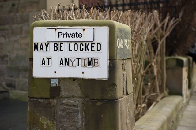
Here's a poison pen parking sign - either they were running out of letters or they like appearing a wee bit sinister:
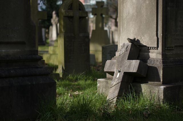
And another week, another cemetery. This one being the Dean Cemetery:
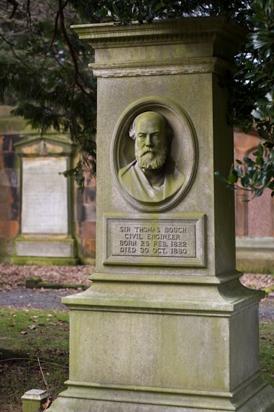
Half of the 19th century's mover and shakers seem to be here. Out of too many to even list, here's the original reason for the visit, being the grave of Thomas Bouch, unfortunate designer of the even more unfortunate first Tay Bridge:
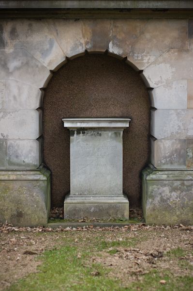
And the remarkably modest grave of William Henry Playfair, who arguably did more than any other individual to shape the way Edinburgh looks (designing the galleries on the Mound and the National Monument, for a start):
Must go back for another look soon...
And another week, another cemetery. This one being the Dean Cemetery:
Half of the 19th century's mover and shakers seem to be here. Out of too many to even list, here's the original reason for the visit, being the grave of Thomas Bouch, unfortunate designer of the even more unfortunate first Tay Bridge:
And the remarkably modest grave of William Henry Playfair, who arguably did more than any other individual to shape the way Edinburgh looks (designing the galleries on the Mound and the National Monument, for a start):
Must go back for another look soon...
All the world seems in tune on a Spring afternoon, when we're poisoning pigeons in the park.
-
Lucky Poet - -
- Posts: 4161
- Joined: Sat Jun 30, 2007 1:15 am
- Location: Up a close
Re: Edinburgh
![]() by Lucky Poet » Sun Mar 10, 2013 10:27 am
by Lucky Poet » Sun Mar 10, 2013 10:27 am
If you head to this site: http://www.projectedinburgh.org/ ...and ignore the managerese guff about science triangles and stakeholders and things, the linked PDFs of the Draft Heritage Framework parts 1, 2, & 3 have some very nicely presented historical type info about Princes Street in particular and the first New Town in general.
All the world seems in tune on a Spring afternoon, when we're poisoning pigeons in the park.
-
Lucky Poet - -
- Posts: 4161
- Joined: Sat Jun 30, 2007 1:15 am
- Location: Up a close
Re: Edinburgh
![]() by Lucky Poet » Wed May 01, 2013 11:39 pm
by Lucky Poet » Wed May 01, 2013 11:39 pm
Lucky Poet wrote:Minor update, anent the Cowgate ex-gap site:
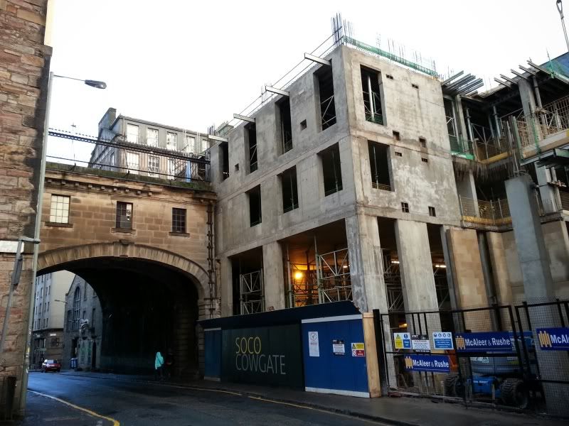
And another. Up to full height now:
All the world seems in tune on a Spring afternoon, when we're poisoning pigeons in the park.
-
Lucky Poet - -
- Posts: 4161
- Joined: Sat Jun 30, 2007 1:15 am
- Location: Up a close
Re: Edinburgh
![]() by Bridie » Fri Jul 05, 2013 3:04 pm
by Bridie » Fri Jul 05, 2013 3:04 pm
HollowHorn wrote:Do you know, I don't see enough of you. You are a big part of what makes HG special for me. I'm so glad I started this thread.................
I echo this too.
My daughter has just moved to Edinburgh and as someone who only discovered the Royal Mile a few years ago this thread has been very entertaining and informative. Thanks
Yes HH,I know
-

Bridie - Third Stripe
- Posts: 2267
- Joined: Thu Jun 18, 2009 11:57 pm
Re: Edinburgh
![]() by Lucky Poet » Fri Jul 05, 2013 9:04 pm
by Lucky Poet » Fri Jul 05, 2013 9:04 pm
Thank you kindly, Bridie 
I hope yer daughter likes it. It's a strange city in its way, but where isn't?
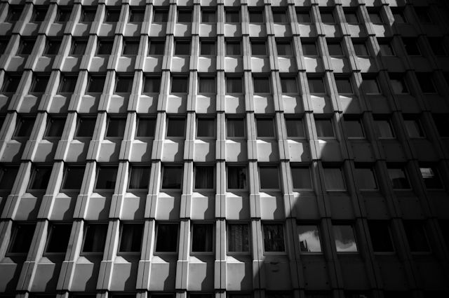
I've realised I've not posted on this thread in ages actually, so here's a snap of Edinburgh's lovely architectural heritage
Admittedly this is about twenty foot down the same road too:
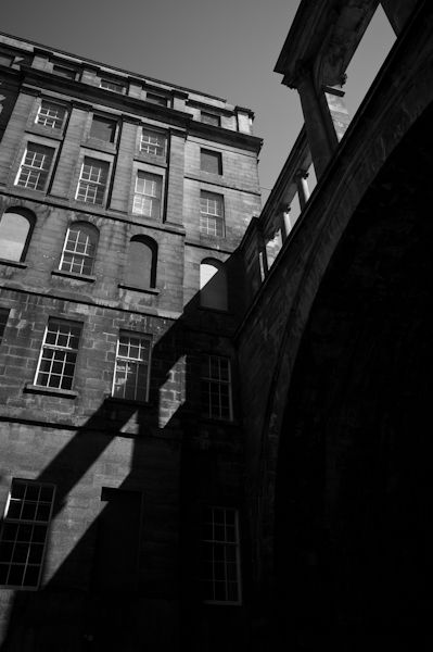
(The top of Calton Road. Trainspotting, and all that.)
I hope yer daughter likes it. It's a strange city in its way, but where isn't?
I've realised I've not posted on this thread in ages actually, so here's a snap of Edinburgh's lovely architectural heritage
Admittedly this is about twenty foot down the same road too:
(The top of Calton Road. Trainspotting, and all that.)
All the world seems in tune on a Spring afternoon, when we're poisoning pigeons in the park.
-
Lucky Poet - -
- Posts: 4161
- Joined: Sat Jun 30, 2007 1:15 am
- Location: Up a close
Re: Edinburgh
![]() by Lucky Poet » Fri Jul 12, 2013 12:09 am
by Lucky Poet » Fri Jul 12, 2013 12:09 am
I recently managed to get my paws on a copy of the 1949 book produced for the Abercrombie Plan, or to give it its proper title, A Civic Survey and Plan for Edinburgh by Sir Patrick Abercrombie and Derek Plumstead:
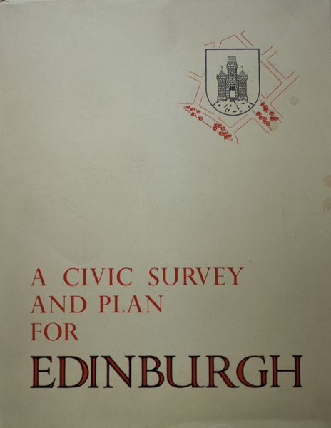
Or, in fact, if you want to seem flash (which it most certainly did): A Civic Survey and Plan for the City and Royal Burgh of Edinburgh. Well, ooh.
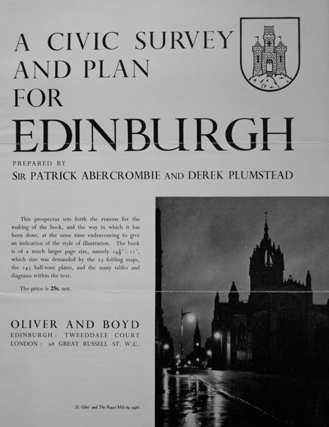
Very smug I feel too, partly as it included a copy of what seems to be the original advertising leaflet:
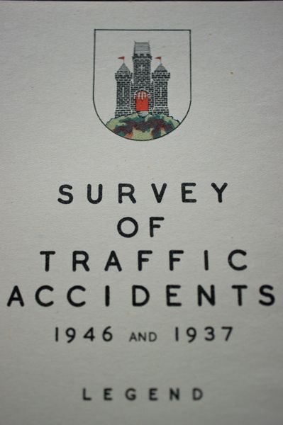
A fair chunk of the book does indeed devote itself to a remarkably in-depth survey of the city, covering housing, schools, employment, industry, all the usual, plus:
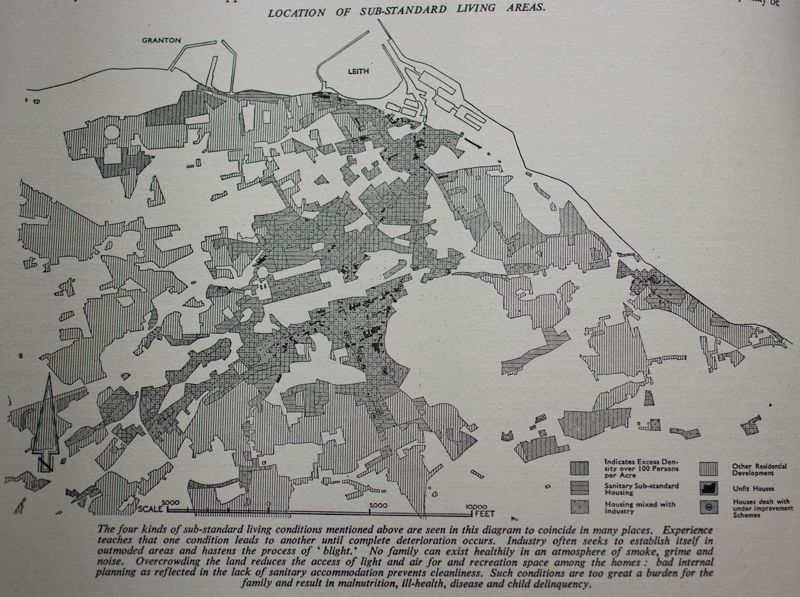
All presented quite beautifully, it has to be said, with maps of various sorts, and some massively complex and thorough tables that would be gold dust to a social historian, which I’m not.
One other section is given over to a historical overview of the city, written by then City Architect and contender for the best-named architect of all time, Ebenezer MacRae. (I should write something up about him actually, partly cos of the name, and partly because he was a disciple of Patrick Geddes.) People have pointed out that MacRae barely disguises his distaste for the final part of the book, and the whole thing it gets towards, the plan for improvement.
This is really what the report was for, of course, and it goes to some length to demonstrate how outmoded and often substandard the old city was:
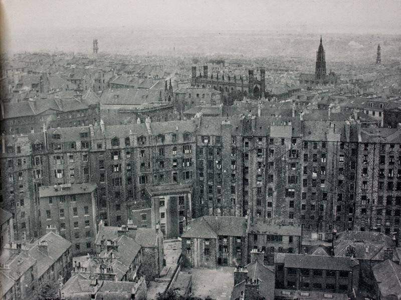
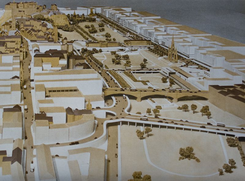
Getting to the point, some of the proposals are pretty startling, all with breezy 1940s styling. Here’s what could have been instead of the city end of the Western Approach Road:
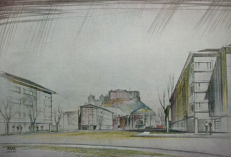
Certainly different from what was there at the time:
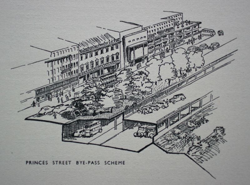
So far, so what: nobody could really object to that very much. (Well, they could, but y’know.) Here’s a pull-out proposing the demolition and replacement of every single building along Princes Street, though:
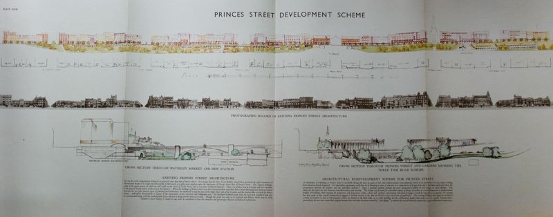
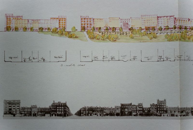
A bit radical, though the writers point out that this couldn’t feasibly be done unless over the course of a number of decades. They suggest that it might reasonably be completed during the 1980s.
Princes Street view, as it could have been:
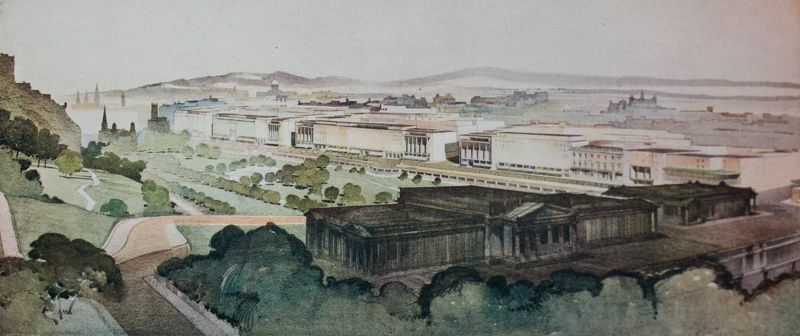
This was the first serious appearance of an overall plan to rationalize the haphazard collection of buildings that is Princes Street, later gone ahead with in the form of the Princes Street Panel’s recommendations. Hence the disconnected series of 1960s & 70s buildings with parts of what would have been a walkway along the first floor exterior; the ongoing project for an overall unified (ish) frontage that was only officially abandoned in the late 1980s. They never did actually explain how the first-floor public walkways were meant to cross the side streets – bridges, steps, or teleport?
Princes Street also would have had a motorway running beneath it:
And the Mound:
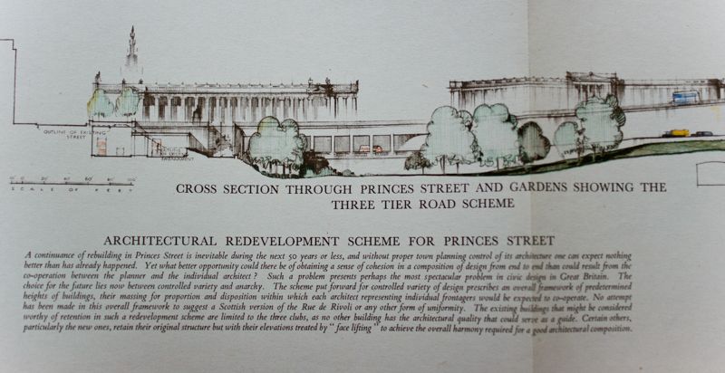
They don’t elaborate as to how mature trees were meant to grow on top of a foot-thick concrete roof for an underground motorway, but hey: Edinburgh was to have had an inner-city motorway. (Telt ye.) And here it would have been:
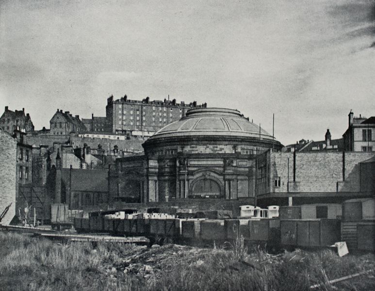
If you can picture an inner ring-road running under Princes Street to the top of Leith Walk, under a massive redevelopment including the ubiquitous theatre/opera house, burrowing under Calton Hill, cutting through the middle of the Royal Mile and off up through the Pleasance, then wandering through the Meadows on concrete stilts, eventually to connect again with the west end of Princes Street, then you’re doing well. Add to that the Mound becoming a subterranean roundabout, connecting by a motorway along Market Street to a roundabout built partly into the (now almost sacrosanct) Old Town ridge:

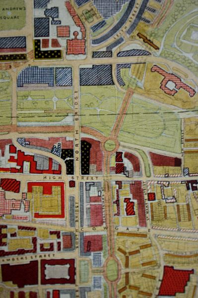
They really meant it. One curious proposal suggested that Waverley Station should be closed, the tracks placed underground with a small station to serve local needs, and the land turned into a park (apart from the motorways running around). A new station would then be built on the site of Princes Street Station, where the Caledonian Hotel still sits, minus its old railway.
Most of this never happened, or at least didn’t in the form that the plan proposed. The outraged response to the plan killed any chance of it going ahead at the time. It did resurface in modified form (including the inner ring road), and some parts went ahead, most notoriously involving the areas around St James and George Squares; arguably the response to these in turn put paid to any further ideas that the planners might have had, and the conservationists won the field. There was one particular councillor who continued to argue in favour of the inner ring road, complete with the Meadows motorway on stilts idea, into the late 80s, but he was seen as something of a lone crank by that point. Anyway, I’ll leave this for now with a couple of artistic renderings of Greenside and St James Square, demolished almost in its entirety in the 1970s, largely left as a hole in the ground for years, and only fairly recently rebuilt:
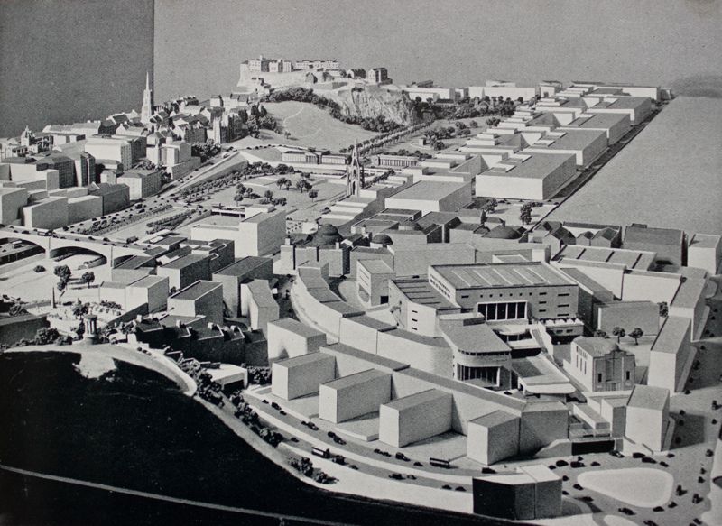
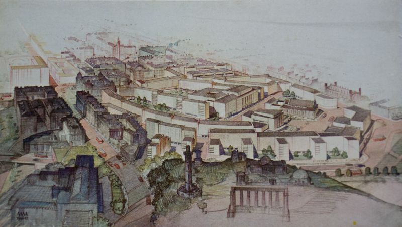
(That last drawing ends up making at least that bit of the whole mad scheme look quite nice, but that's artist's impressions for you, I suppose.)
Or, in fact, if you want to seem flash (which it most certainly did): A Civic Survey and Plan for the City and Royal Burgh of Edinburgh. Well, ooh.
Very smug I feel too, partly as it included a copy of what seems to be the original advertising leaflet:
A fair chunk of the book does indeed devote itself to a remarkably in-depth survey of the city, covering housing, schools, employment, industry, all the usual, plus:
All presented quite beautifully, it has to be said, with maps of various sorts, and some massively complex and thorough tables that would be gold dust to a social historian, which I’m not.
One other section is given over to a historical overview of the city, written by then City Architect and contender for the best-named architect of all time, Ebenezer MacRae. (I should write something up about him actually, partly cos of the name, and partly because he was a disciple of Patrick Geddes.) People have pointed out that MacRae barely disguises his distaste for the final part of the book, and the whole thing it gets towards, the plan for improvement.
This is really what the report was for, of course, and it goes to some length to demonstrate how outmoded and often substandard the old city was:
Getting to the point, some of the proposals are pretty startling, all with breezy 1940s styling. Here’s what could have been instead of the city end of the Western Approach Road:
Certainly different from what was there at the time:
So far, so what: nobody could really object to that very much. (Well, they could, but y’know.) Here’s a pull-out proposing the demolition and replacement of every single building along Princes Street, though:
A bit radical, though the writers point out that this couldn’t feasibly be done unless over the course of a number of decades. They suggest that it might reasonably be completed during the 1980s.
Princes Street view, as it could have been:
This was the first serious appearance of an overall plan to rationalize the haphazard collection of buildings that is Princes Street, later gone ahead with in the form of the Princes Street Panel’s recommendations. Hence the disconnected series of 1960s & 70s buildings with parts of what would have been a walkway along the first floor exterior; the ongoing project for an overall unified (ish) frontage that was only officially abandoned in the late 1980s. They never did actually explain how the first-floor public walkways were meant to cross the side streets – bridges, steps, or teleport?
Princes Street also would have had a motorway running beneath it:
And the Mound:
They don’t elaborate as to how mature trees were meant to grow on top of a foot-thick concrete roof for an underground motorway, but hey: Edinburgh was to have had an inner-city motorway. (Telt ye.) And here it would have been:
If you can picture an inner ring-road running under Princes Street to the top of Leith Walk, under a massive redevelopment including the ubiquitous theatre/opera house, burrowing under Calton Hill, cutting through the middle of the Royal Mile and off up through the Pleasance, then wandering through the Meadows on concrete stilts, eventually to connect again with the west end of Princes Street, then you’re doing well. Add to that the Mound becoming a subterranean roundabout, connecting by a motorway along Market Street to a roundabout built partly into the (now almost sacrosanct) Old Town ridge:
They really meant it. One curious proposal suggested that Waverley Station should be closed, the tracks placed underground with a small station to serve local needs, and the land turned into a park (apart from the motorways running around). A new station would then be built on the site of Princes Street Station, where the Caledonian Hotel still sits, minus its old railway.
Most of this never happened, or at least didn’t in the form that the plan proposed. The outraged response to the plan killed any chance of it going ahead at the time. It did resurface in modified form (including the inner ring road), and some parts went ahead, most notoriously involving the areas around St James and George Squares; arguably the response to these in turn put paid to any further ideas that the planners might have had, and the conservationists won the field. There was one particular councillor who continued to argue in favour of the inner ring road, complete with the Meadows motorway on stilts idea, into the late 80s, but he was seen as something of a lone crank by that point. Anyway, I’ll leave this for now with a couple of artistic renderings of Greenside and St James Square, demolished almost in its entirety in the 1970s, largely left as a hole in the ground for years, and only fairly recently rebuilt:
(That last drawing ends up making at least that bit of the whole mad scheme look quite nice, but that's artist's impressions for you, I suppose.)
All the world seems in tune on a Spring afternoon, when we're poisoning pigeons in the park.
-
Lucky Poet - -
- Posts: 4161
- Joined: Sat Jun 30, 2007 1:15 am
- Location: Up a close
Re: Edinburgh
![]() by HollowHorn » Fri Jul 12, 2013 8:43 pm
by HollowHorn » Fri Jul 12, 2013 8:43 pm
Amazing, in a Bruce Plan type of way. 
Yes Bridie, you do.
-

HollowHorn - Third Stripe
- Posts: 8921
- Joined: Mon May 23, 2005 9:59 pm
- Location: Paisley
Re: Edinburgh
![]() by Lucky Poet » Sun Jul 14, 2013 5:11 pm
by Lucky Poet » Sun Jul 14, 2013 5:11 pm
Very much of the same time. For various reasons, it never really took off in Edinburgh. Partly because historical appearance has been embedded in that city's psyche since at least the 1700s, and also because especially the later motorway ideas infringed upon the professional middle class's area of town, and they were actually still quite fond of living in the centre of town. Add the dismal demonstration of the St James Centre and the Uni's destruction of the Bristo Street and George Square area, and the game was up by the mid-70s. No more large demolitions took place after that, though there were many gap sites till well into the 1990s.
All the world seems in tune on a Spring afternoon, when we're poisoning pigeons in the park.
-
Lucky Poet - -
- Posts: 4161
- Joined: Sat Jun 30, 2007 1:15 am
- Location: Up a close
Re: Edinburgh
![]() by Toby Dammit » Mon Jul 15, 2013 11:32 am
by Toby Dammit » Mon Jul 15, 2013 11:32 am
Lucky Poet wrote:the Abercrombie Plan
Astounding. They should show this abomination to every student of architecture and town planning on the planet and if any of them puts up a hand and says "great idea!" they should be barred from practicing for life. Never heard of it before, though the names Abercrombie and Plumstead sounds like an innocuous pair of English cricket chaps from the 1920's rather than... what to describe them, cultural vandals? Arse holes? Dangerous people at any rate. Their Brummie and Glasgow equivalents had greater "success" though.
travel, films and stuff https://freakydog.wordpress.com/
-

Toby Dammit - Third Stripe
- Posts: 477
- Joined: Thu May 11, 2006 11:27 pm
- Location: Laaaandan
Re: Edinburgh
![]() by Lucky Poet » Sun Jul 21, 2013 12:33 am
by Lucky Poet » Sun Jul 21, 2013 12:33 am
I can't say I disagree, really. The 70s plans were arguably worse, than the 40s version, but maybe that's down to the passage of time lending the 40s stuff a certain cutesy alternative universe glamour. (That very well might just be me, of course.)
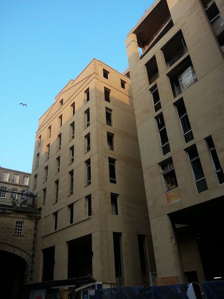
Back in the here and now, and, well. I'm not going to say anything except that this carries on and on:
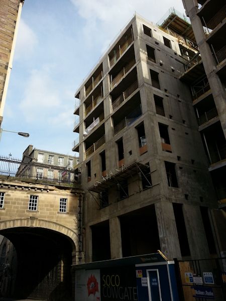
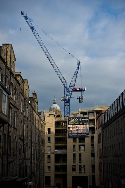
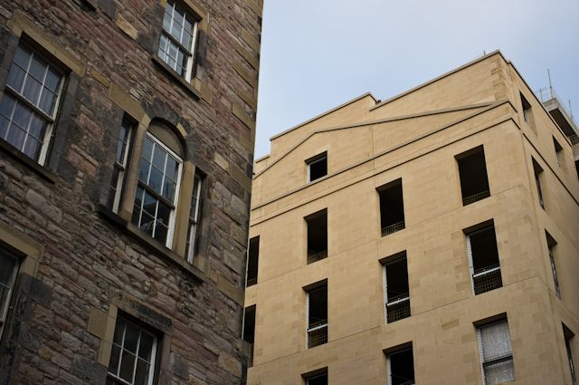
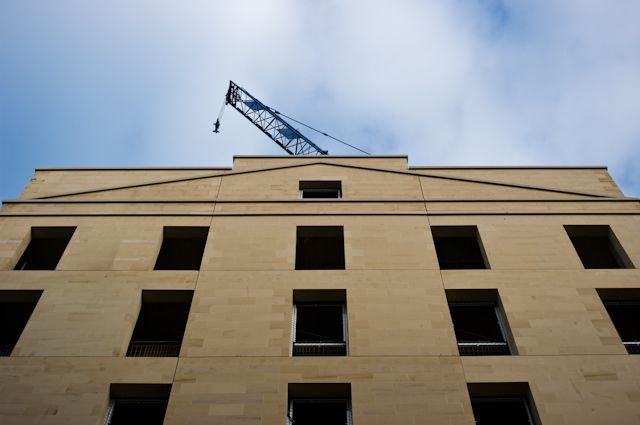
More productively, the Cowgate construction thing is nearing completion. I'm still not entirely convinced, but it's nice to see the place filled up:
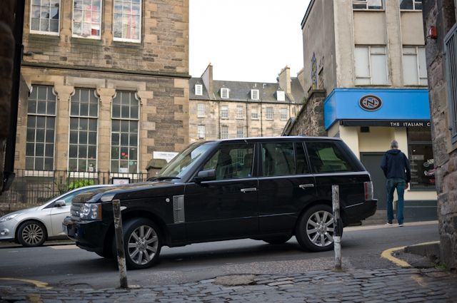
Elsewhere, it's Mind My Posh Car, Edinburgh edition:
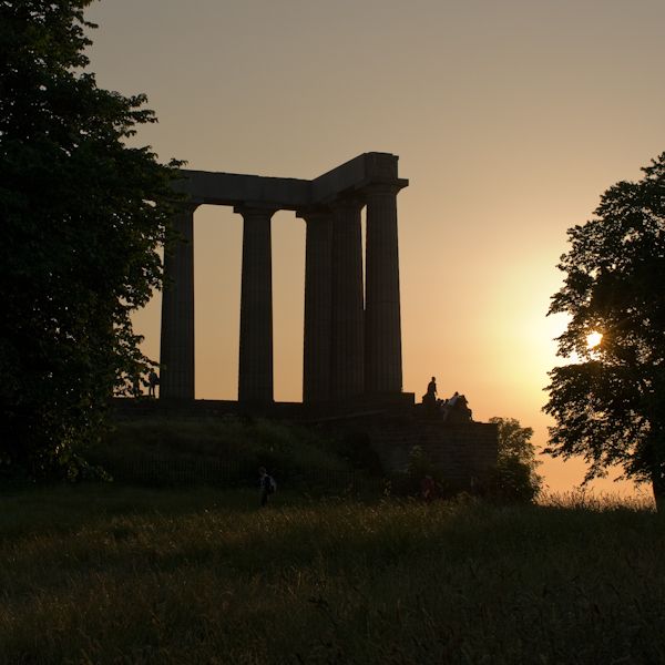
And, well, an actual SUMMER:
Back in the here and now, and, well. I'm not going to say anything except that this carries on and on:
More productively, the Cowgate construction thing is nearing completion. I'm still not entirely convinced, but it's nice to see the place filled up:
Elsewhere, it's Mind My Posh Car, Edinburgh edition:
And, well, an actual SUMMER:
All the world seems in tune on a Spring afternoon, when we're poisoning pigeons in the park.
-
Lucky Poet - -
- Posts: 4161
- Joined: Sat Jun 30, 2007 1:15 am
- Location: Up a close
Re: Edinburgh
![]() by Josef » Sun Jul 21, 2013 3:57 am
by Josef » Sun Jul 21, 2013 3:57 am
One of those snaps has gone walkies, just in case you hadn't noticed.
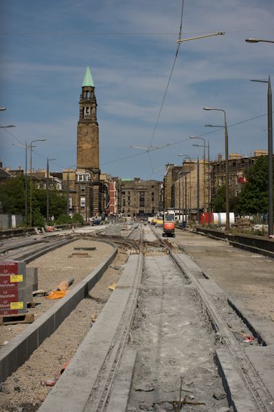
Is the new line that they appear to be building near Haymarket part of the Train Set, or a light rail kinda thing?
Is the new line that they appear to be building near Haymarket part of the Train Set, or a light rail kinda thing?
-

Josef - Third Stripe
- Posts: 8144
- Joined: Mon Jul 10, 2006 9:43 pm
Re: Edinburgh
![]() by Lucky Poet » Sun Jul 21, 2013 10:40 am
by Lucky Poet » Sun Jul 21, 2013 10:40 am
Fixed, for now at least. (That's the third time I've had to change that link.)
As far as I know it's Cooncil Train Set doings. Heavy duty stuff, partly hence the cost of the blasted thing.
As far as I know it's Cooncil Train Set doings. Heavy duty stuff, partly hence the cost of the blasted thing.
All the world seems in tune on a Spring afternoon, when we're poisoning pigeons in the park.
-
Lucky Poet - -
- Posts: 4161
- Joined: Sat Jun 30, 2007 1:15 am
- Location: Up a close
Re: Edinburgh
![]() by Josef » Sun Jul 21, 2013 3:51 pm
by Josef » Sun Jul 21, 2013 3:51 pm
It actually looks pretty damn handy. Stops in the kind of places you can imagine wanting to stop.
And doubtless a great deal more useful than a bloody Velodrome, but that's a rant for a different thread.
And doubtless a great deal more useful than a bloody Velodrome, but that's a rant for a different thread.
-
Josef - Third Stripe
- Posts: 8144
- Joined: Mon Jul 10, 2006 9:43 pm
Who is online
Users browsing this forum: No registered users and 17 guests