


To post in the forums you will need to first register. All new members are welcomed, with one caveat: You must behave and be nice AND SEARCH BEFORE POSTING!
Moderators: John, Sharon, Fossil, Lucky Poet, crusty_bint, Jazza, dazza
![]() by toomse » Tue Jul 21, 2009 2:14 pm
by toomse » Tue Jul 21, 2009 2:14 pm

![]() by toomse » Tue Jul 21, 2009 2:47 pm
by toomse » Tue Jul 21, 2009 2:47 pm


![]() by toomse » Wed Jul 22, 2009 10:36 am
by toomse » Wed Jul 22, 2009 10:36 am


![]() by purplepantman » Thu Jul 23, 2009 7:11 pm
by purplepantman » Thu Jul 23, 2009 7:11 pm
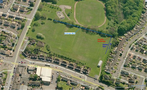
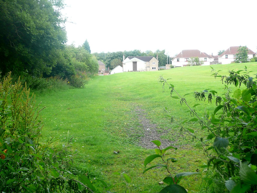
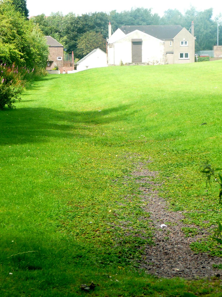
toomse wrote:was surprised to come across this Bronze Age Burial Ground just north east of Barrachnie Park in a residential area
![]() by Icecube » Thu Jul 23, 2009 7:39 pm
by Icecube » Thu Jul 23, 2009 7:39 pm
![]() by Glesga_Steve » Thu Jul 23, 2009 10:09 pm
by Glesga_Steve » Thu Jul 23, 2009 10:09 pm
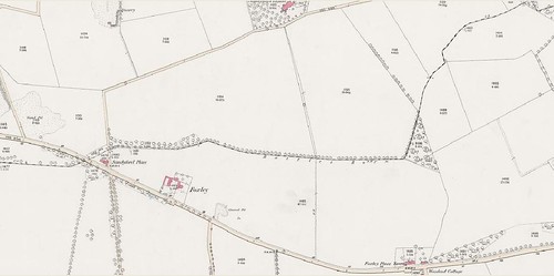
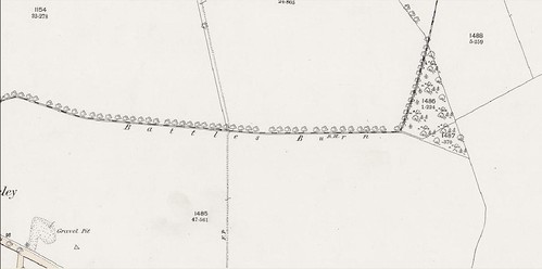
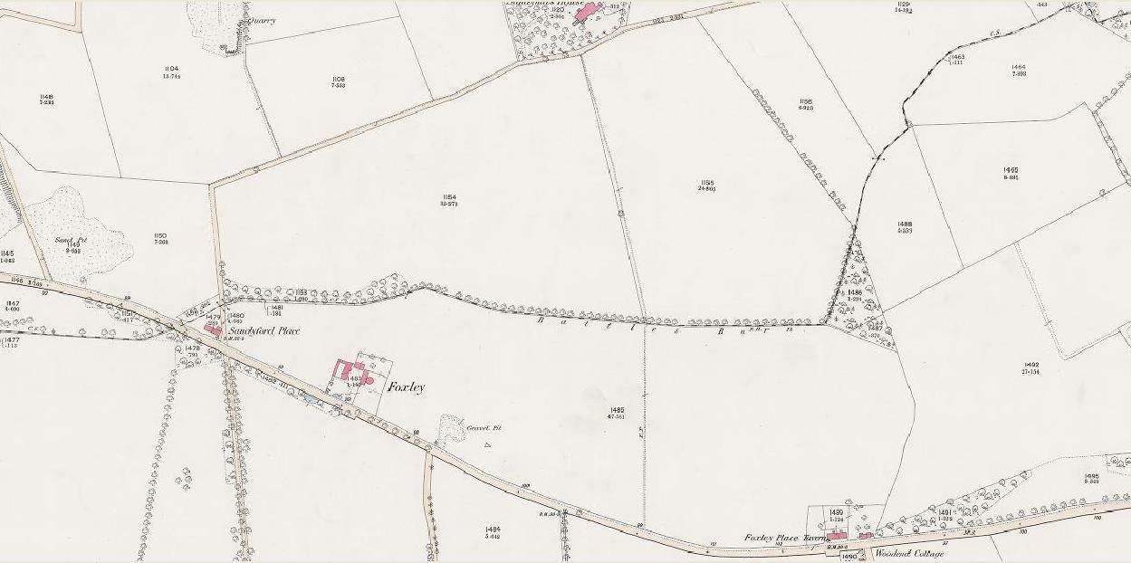
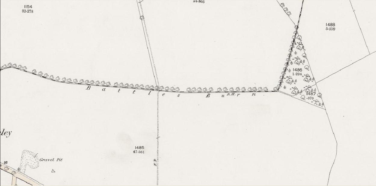
Icecube wrote:Toomse I have to say that the Battle Burn originating at Barrachnie Park is a new one on me, no burn there at all. The dotted line extending through Mount Vernon to the west of Barrachnie park refers to the old parish boundary between Old Monkland and Barony. I think somebody's records are confused.


![]() by Icecube » Thu Jul 23, 2009 10:23 pm
by Icecube » Thu Jul 23, 2009 10:23 pm
![]() by Glesga_Steve » Thu Jul 23, 2009 10:44 pm
by Glesga_Steve » Thu Jul 23, 2009 10:44 pm

![]() by Glesga_Steve » Fri Jul 24, 2009 5:59 pm
by Glesga_Steve » Fri Jul 24, 2009 5:59 pm


![]() by Icecube » Fri Jul 24, 2009 8:28 pm
by Icecube » Fri Jul 24, 2009 8:28 pm
![]() by Glesga_Steve » Fri Jul 24, 2009 11:57 pm
by Glesga_Steve » Fri Jul 24, 2009 11:57 pm
![]() by Icecube » Sat Jul 25, 2009 12:27 am
by Icecube » Sat Jul 25, 2009 12:27 am

![]() by Glesga_Steve » Sat Jul 25, 2009 11:50 pm
by Glesga_Steve » Sat Jul 25, 2009 11:50 pm
Icecube wrote:Despite the above I'm not saying I've won the argument.
![]() by Icecube » Sun Jul 26, 2009 6:23 pm
by Icecube » Sun Jul 26, 2009 6:23 pm
![]() by Glesga_Steve » Sun Jul 26, 2009 7:40 pm
by Glesga_Steve » Sun Jul 26, 2009 7:40 pm
Return to Hidden Glasgow Projects
Users browsing this forum: Google [Bot] and 5 guests