Page 10 of 15

Re: Molendinar Burn

PostPosted: Thu Feb 19, 2009 10:26 am
by toomse
Ronnie,
I’ve posted all locations of the Molly on the OS maps that I could find. There’s nothing recorded from Craigend Avenue until it appears at the rear of the Great Eastern Hotel.

Perhaps My Kitten could help. Maybe she could apply to the Water Board for diagrams of the full route
viewtopic.php?f=3&t=8257&p=167539&hilit=pu+prints#p167539

My Kitten wrote:I used to get them quite frequently in a previous employment, just a letter with a map showing the area that we wanted and a package would appear soonafter.

Re: Molendinar Burn

PostPosted: Thu Feb 19, 2009 11:55 am
by My Kitten
toomse wrote:Ronnie,
I’ve posted all locations of the Molly on the OS maps that I could find. There’s nothing recorded from Craigend Avenue until it appears at the rear of the Great Eastern Hotel.

Perhaps My Kitten could help. Maybe she could apply to the Water Board for diagrams of the full route
viewtopic.php?f=3&t=8257&p=167539&hilit=pu+prints#p167539

My Kitten wrote:I used to get them quite frequently in a previous employment, just a letter with a map showing the area that we wanted and a package would appear soonafter.


Wish I could, was a while ago now. Any engineers on the site that could get them delivered to work ;)

Re: Molendinar Burn

PostPosted: Thu Feb 19, 2009 3:35 pm
by toomse
If you want a job done…………


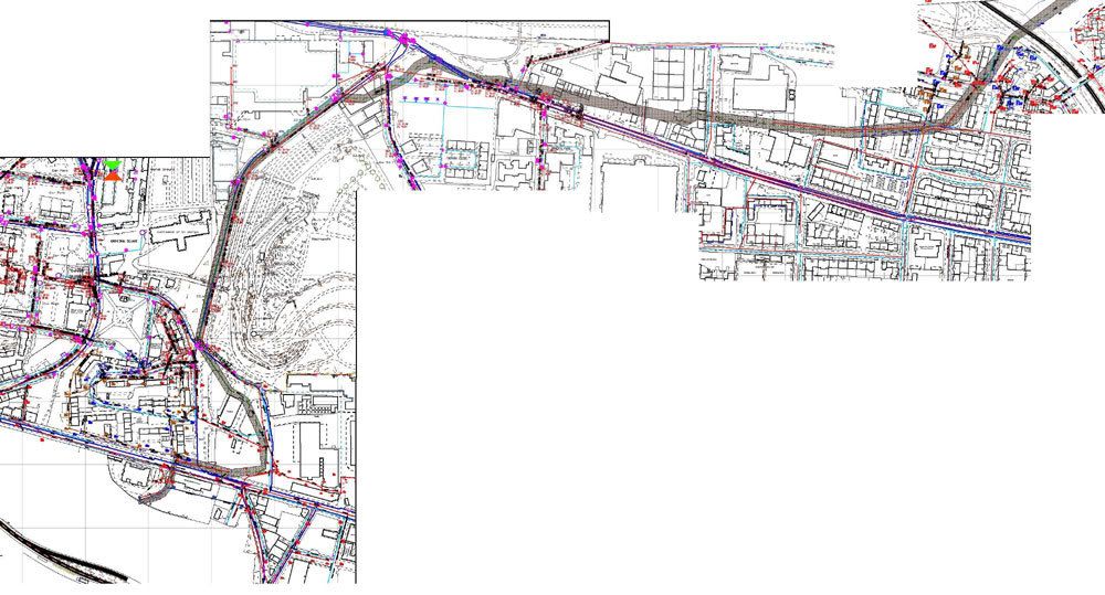
I’ve posted the equivalent Os maps to help align with the Water Board diagrams
The Molly is the grey river looking thingy with the dotted green line up the middle

Image


Image


Image


Image


Image


Image


Image


Image


Ronnie,
PM me an E mail address if you like and I’ll send you the PDF files - you can scale these up to view in greater detail

Re: Molendinar Burn

PostPosted: Thu Feb 19, 2009 6:23 pm
by BenCooper
Oh look, I was pretty much bang on :D

Does your plan show where the upstream tunnel splits into two tunnels? That's as far as I got upstream, and it'd be nice to know where this is.

Re: Molendinar Burn

PostPosted: Sun Feb 22, 2009 10:08 pm
by Ronnie
Thanks, Toomse. Now we know that the Molly does indeed travel under the brewery site.

Re: Molendinar Burn

PostPosted: Sun Feb 22, 2009 11:26 pm
by Lucky Poet
Not that I wish to second guess the Victorians, but is this not several building collapses waiting to happen?

Re: Molendinar Burn

PostPosted: Mon Feb 23, 2009 8:34 am
by BenCooper
I'm going to try matching up my photographs with the maps, but from memory the section under the brewery is all modern steel pipe, not Victorian brick or stone.

Though, looking at the brick and stone sections, I'd trust them just as much if not more.

Re: Molendinar Burn

PostPosted: Fri Mar 06, 2009 2:39 pm
by toomse
additional diagrams for the route along Alexandra Parade

Image


Image


Image


Image


Image


Image

Re: Molendinar Burn

PostPosted: Fri Mar 06, 2009 7:56 pm
by crusty_bint
Image

Re: Molendinar Burn

PostPosted: Sat Mar 07, 2009 8:10 pm
by toomse
route south from College Goods yard

Image

Re: Molendinar Burn

PostPosted: Sat Mar 07, 2009 11:21 pm
by BenCooper
Do you have that last one in higher resolution? It pops out by the High Court, but I can't see how it does that on that map...

Re: Molendinar Burn

PostPosted: Sun Mar 08, 2009 12:40 am
by toomse
Image


Image


Image


Image


Image


Image


Image


Image


Image


Image


Image


Image


Image


Image

Re: Molendinar Burn

PostPosted: Sun Mar 08, 2009 9:37 am
by BenCooper
Thank you :D

That's really odd - I was sure it went out the outfall under the High Court, but it looks like that's a sewer overflow or something, doesn't it? On old maps, the High Court ourflow matches up with the old position of the stream, but I guess they must have realigned it.

Re: Molendinar Burn

PostPosted: Thu Mar 12, 2009 9:23 pm
by fullfatmilk
Hi folks

I took some pictures of the Molendinar Burn 'waterfall' the other day.

It is located near the site of the old Blackhill Community Centre as shown here on google maps

http://maps.google.co.uk/?ie=UTF8&ll=55.877289,-4.194511&spn=0.000746,0.002403&t=h&z=19

Image

Image

Image

Image

Image

Image

Image


I think the site is now offically called 'Molendinar Park', not much of a park but the water feature is a far cry from the cesspit and general health hazard that the burn used to be at that particular location.

Re: Molendinar Burn

PostPosted: Fri Mar 13, 2009 12:20 am
by fullfatmilk
Previous image posting error resolved! (sorry)